
Don, Duc, Ben and Cliff with their 4 Land Cruisers tackle the famed Mojave Road. All of us had traveled the two Interstates I-15 & I-40 that the Mojave Road runs between and they are not that scenic. So we were surprised by the diverse scenery we found on the Mojave Road.
Don came down from northern Oregon to join us and we made our way to Barstow, where we had dinner at Tommy’s, a Los Angeles/SoCal institution since 1946. We had their chili cheeseburgers before leaving civilization behind. We spent three days on the trail, camping out along the trail for three nights. The first night at Afton Canyon Campground, the 2nd at Mojave Campground (do not recommend), and the 3rd at Mid Hills. A couple of the nights were pretty windy and cold in the tent. The fourth night was at the KOA in Needles, CA.
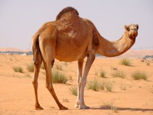
The Mojave Road has an old history, as long before Europeans arrived, it was an ancient trade route between the Colorado River and the Pacific Ocean. In 1776 the Spanish Friar Garces was first European to use it. The discovery of gold in 1849 created the need for more routes to California which brought about an odd chapter in US history. To deal with the challenging conditions in the deserts of the Southwest, in 1856 the US Army imported 70 camels and some camel handlers. These camels were used to survey a southern wagon route to California from Texas which opened in 1858. The Mojave Road was used as the western section. For more on the camels click here: U.S. Army Camel Corps
The Mojave Desert can be a very unforgiving place for the unprepared. It can be blistering hot, mighty cold, windy, etc. There are lots of forks in the road where you can get lost and no one will happen to go that way for months. For the most part there are no signs on the 138 miles of the Road (we saw only 3 or 4 on the east end). The harshness of the desert was brought home as we usually see wildlife on an a trip, but we only saw one kangaroo rat on this trip.
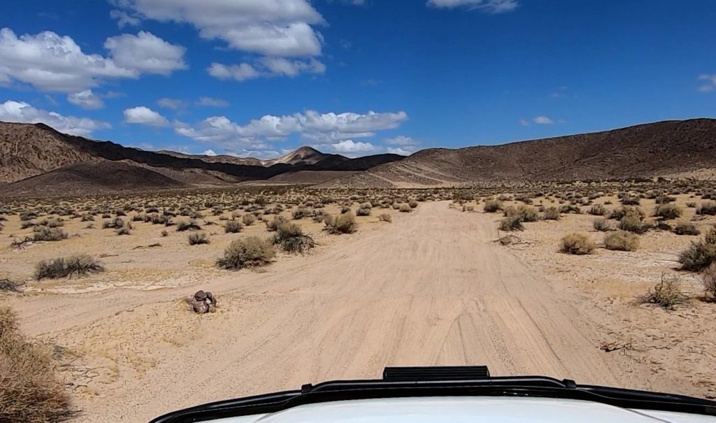
The road is marked with rock cairns (see photo above) on left side of the road when traveling from west to east. The philosophy behind this is that folks venturing down this road needed to be prepared for the conditions and making the route finding a bit of a challenge set a higher bar for those attempting it. While my GPS usually does well in the backcountry, it had difficulty following the Mojave Road and in several places it was no help at all. Due to this we missed about five miles of the Road as we were following a worn track in the sand of several others who has missed their turn. Using the guide book mentioned below we were able to link up with road further on.
Due to the challenges and lack of signs on the road, having Dennis Casebier’s book Mojave Road Guide is really a requirement. It is recommended that at least the first part of the book be read while planning a trip. Dennis was instrumental in remapping and popularizing the Mojave Road for the 4WD community.
At Desert USA for about $20 Mojave Road Guide
At Amazon for about $10 more Mojave Road Guide
Eight of these photos were taken by Ben and six were taken by Duc.
Sit back and enjoy a trip down the Mojave Road via the following photos.
Clicking one of the buttons above the photos will show only the photos for that topic. Clicking the “All” button will bring everything back.
Clicking on a photo in gallery view takes you to single photo display, in this mode the mouse scroll wheel will zoom in/out and you can drag view around with the mouse. In single photo view you can step through photos by clicking on arrows on right and left side of photo. In single photo display you can download the photo (Button in upper right, arrow pointing down).
For help with the photo gallery features click the help button to the far right.