
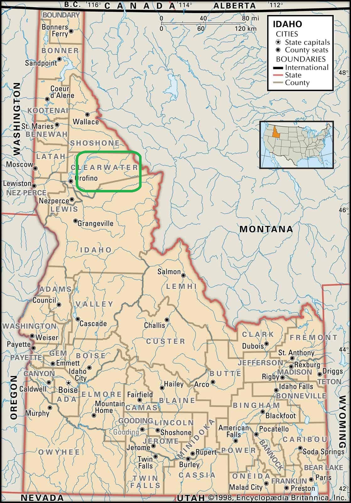
Northern Idaho Trip (in the footsteps of Lewis and Clark) Area circled in green on map.
On August 6 we all met up in Kooskia, ID, Mike, Tucker & Ben from California, Mark & Cliff from Idaho, and Vince from Wyoming. After topping our gas tanks, we headed to the western end of the Lolo Motorway, a road built in the 1930s by the Civilian Conservation Corps, the Motorway closely paralleling the original Lolo Trail. The Motorway is currently a segment of the Idaho Backcountry Discovery Route. (The Lolo Trail and Motorway seem to be used interchangeably these days so I will be using Lolo Trail to describe our travels.)
We are indebted to Mark for the planning for this trip as it is tough to get up-to-date information on this remote area. Even with the in-depth planning, we did have to detour a few times due to Forest Service Road closures and a landslide.
The Lolo Trail has a very significant history so feel I should discuss that a bit. The trail has been used by Native Americans for thousands of years. It was used by Lewis and Clark in 1805 and again in 1806.
With the Louisiana Purchase in 1803, President Thomas Jefferson wanted the area explored and mapped all the way to the Pacific Ocean and commissions Meriwether Lewis to organize it. Folks of the time hoped there would be an easy land passage (the mythical Northwest Passage) between the Missouri River system and the Columbia River system that would make travel easier to the Pacific.
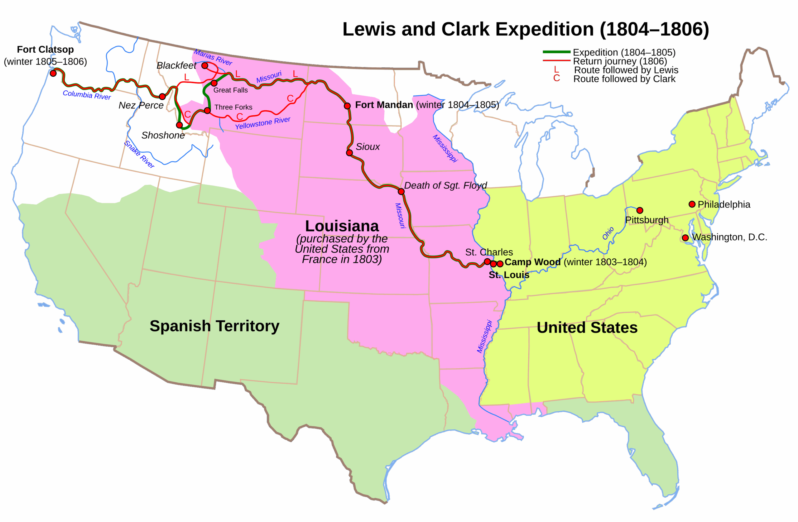
May 14, 1804 – The Lewis and Clark Corps of Discovery start their expedition from St Louis using boats going upstream on the Missouri River. Most of their travel was on rivers for the expedition rather than overland. Of Lewis and Clark’s 8,000-mile round trip, crossing the Bitterroot Mountains on the Lolo Trail was the most challenging and discouraging part.
September 11, 1805 – The Corps of Discovery realized there was no easy overland route between the Missouri and Columbia rivers and began its brutal overland crossing of the Bitterroot Mountains—a 160 mile stretch that would become the most agonizing leg of their journey West. They took a wrong turn at the start and the trail back to the Lolo Trail was a tangle of fallen timber, steep ascents, deep ravines, and dense underbrush. With rations dwindling, snow beginning to fall, and no game to hunt because of the high terrain, the men faced starvation. Near the South Fork of what they named the Flathead River, they were forced to kill and eat a colt to survive.
Lewis: “The mountains which we passed today [were] much worse than yesterday… excessively bad and thickly strowed with fallen timber… our men and horses much fatigued.”
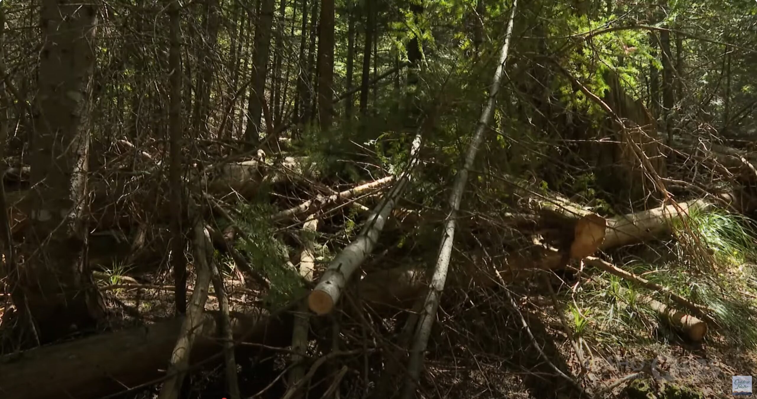
From PBS series on the Bitterroots showing efforts to clear the Trail. Click to view larger
September 18, 1805 – Now three miles west of Bald Mountain, the Corps was at a dire low point. Starving and exhausted, they turned to the last of their portable soup—a gelatinous ration the men detested—and prepared to eat bear’s oil and even candles if necessary. Lewis noted their desperate condition as they clung to life in one of the harshest terrains they had ever encountered.
September 22, 1805 – At the end of their rope, they arrive at a Nez Perce village. The Nez Perce people gave them aid and guided them to the Clearwater River.
June 1806 – Returning from their winter camp in Astoria, OR, they again tackle the Lolo Trail and it proved just as challenging heading East.
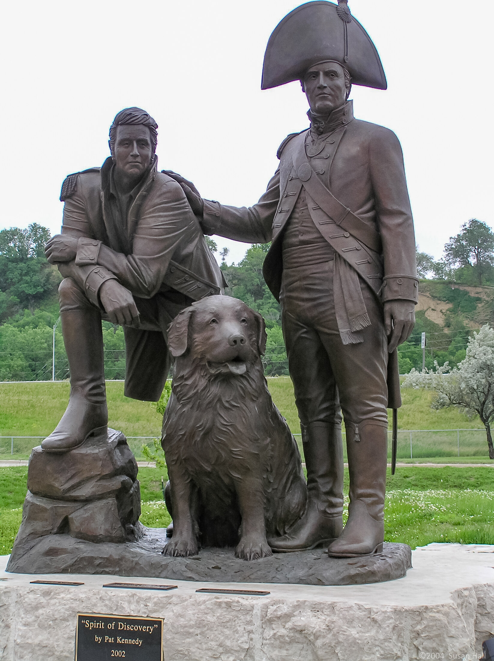
If you want to know more about the Lewis and Clark Expedition
The book Undaunted Courage by Stephen Ambrose is a great place to start.
If you have access to PBS the Ken Burns Lewis and Clark Documentary is very good.
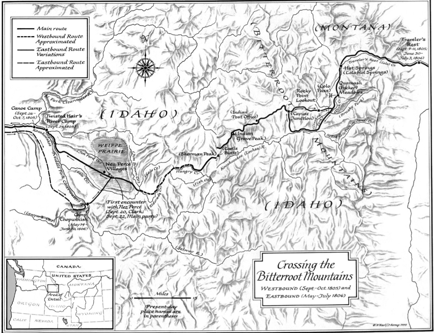
We did not have the hardships the Lewis and Clark’s expedition suffered. Our 4WD vehicles traveled the Lolo Motorway (Trail). We took the Lolo Trail from West to East, the direction Lewis and Clark took on their their way home in 1806. Also, with GPS and a lot of planning we avoided taking a wrong turn, as Lewis and Clark did.
As we traveled to the official start of the Lolo Trail, we passed some historical signs about Lewis and Clark travels. After starting on Lolo Trail we took a side road to Weitas Butte Lookout where we planned to camp if there is enough level ground. However before reaching the Lookout, we encountered a number of fallen trees. Unlike Lewis and Clark, we had chainsaws and can make short work of it. The Lookout, though no longer in use and locked up, was a great spot so we set up camp there for the first night.
The next day (8/7) we enjoyed the wildflowers and huckleberries on the way to Liz Butte Road and up to Liz Butte Cabin (which can be rented). From the Liz Butte Cabin we headed back to Lolo Trail and on to the Castle Butte Lookout (also for rent) which was socked in by a low clouds when we arrived. We were not invited up by the folks staying there, and the view wasn’t very good at the time. The next stop on the Trail was the Indian Post Office which has great views of the mountains and the lake below. Another several miles we found a great campsite and set up camp and got the campfire going. As we were making dinner, we had a number of rain showers from a thunderstorm passing North of us.
On 8/8 we left the Lolo Trail and took a side road which descends down to Highway 12 and the Lochsa Lodge for gas. Then it was long climb back up to the Lolo Trail and back along the Trail to the Cayuse Junction where we left the Lolo Trail to head Northwest and explore more of the Bitterroots. The trail we had turned onto appeared little used, and then it became overgrown for miles. We finally arrived at the Cayuse Creek Airstrip and set up camp. Once settled in, some horses checked out the runway.
On 8/9 as we were packing up to leave, Mike asked about the landslide on our route that showed on one of the maps we had. The other maps we had didn’t show it, so we decided to check at the Ranger Station before the turnoff for the road with the slide. Following Kelly Creek to Kelly Forks where it dumps into the North Fork Clearwater River, we checked at the Ranger Station there and, sure enough, the landslide had taken out the road years ago and it had not been repaired. That meant we needed to take the longer way along the North Fork Clearwater River, which was very scenic and had the fishermen in the our group wishing they could do some casting when they saw other folks fishing. It proved to be a day of detours, as the Forest Service had permanently or temporally closed several of the roads we wanted to use. Late in the afternoon we found a great campsite on a Forest Service detour at Browns Rock. Mike decided it was time to head home and left before dinner. Late that night we could see the full moonrise.
On 8/10 we headed to Pierce for gas, most of us concerned, due to all the detours, that we might run out of gas before getting there. With our tanks full, we headed out of town where we found a spot for lunch. After lunch it was time for Vince to head back to Wyoming. For Mark, Ben, Tucker and Cliff there were a number of old mines ahead that we thought would be neat to explore. However, we found that the Forest Service doesn’t want people exploring those mines and had blocked off the roads way before you get to them. We did get to tour the Hemlock Lookout which is actively manned. That night we camped near the Red Cloud Mine.
On 8/11 The rest of us headed for our homes.
Of the photos below, Ben provided 15 and Mike provided 2 .
Picking Huckleberries Video by Ben
Video of Western end of Lolo Trail
Video of the rest of Lolo Trail – 20 minutes of driving various sections of the Lolo Trail, trail can start to look the same if not into the detail.